The course is designed for Geoscientists, Petrophysicists, Reservoir Engineers and Well Engineers. Ideally structured for groups working in multi-discipline asset-based teams.
Duration
Flexible from 3 to 4 days
Learning Level
Skills
Knowledge
Awareness
What’s here?
Superb exposures of fault systems within the Triassic/Lower Jurassic of the East Bristol Channel and Central Somerset Basins.
3D seismic scale fault systems including a variety of fault geometries, fabrics and networks.
Supported by materials on stress, strain and fracture development as well as fault seal and trap analysis.
Geological Themes
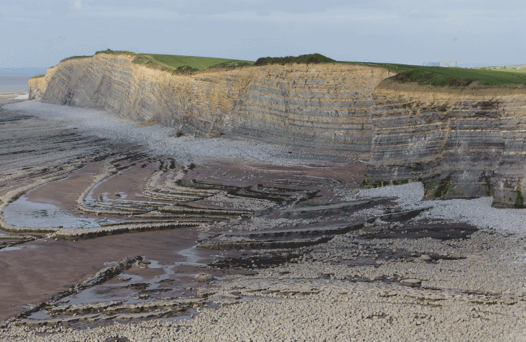
Fault systems exposed on the North Somerset foreshores deform Triassic to Lower Jurassic stratigraphy and are located on the southern margin of the Mesozoic to Tertiary, E-W and NW-SE trending East Bristol Channel and Central Somerset Basins.These Basins link the Main Bristol Channel Basin with the western part of the Wessex Basin located to the east.The Triassic strata comprise a series of red mudstones and siltstones laid down in playa lake settings.These are overlain by lacustrine and marine gypsiferous marls, siltstones, sandstones and dolomites of the Blue Anchor Series. Rhaetian marine mudstones and finally marine marls and limestones of the Blue Lias Formation of the Lower Jurassic complete the transgressive sequence.
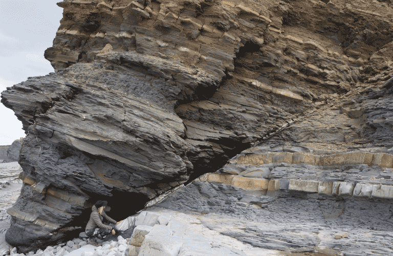
Excellent 3D examples of extensional fault systems are exposed in the cliffs and on the foreshore at Kilve in North Somerset along the southern margin of the Bristol Channel.Extensional faults range from a few metres to several hundred metres in strike-lengths and occur in dark coloured shales and interbedded limestones.
Extensional and inverted fault systems are also exposed in the cliffs and on the foreshore at Watchet in North Somerset along the southern margin of the Bristol Channel.Inverted Upper Jurassic extensional faults juxtapose grey Lower Jurassic (Lower Lias) shales and interbedded limestones against the red Upper Triassic Mercia mudstones.
Course Content
In summary the region as a whole offers an excellent backdrop for the inclusion of a variety of structural fault analysis technical themes including:
Methods for quantification of fault properties
Sealing capacity and threshold pressure
Impact on well design (trajectories) and well planning
Mapping and QC of mapped fault networks
Quantification of fault transmissibilities
Representation of open fault damage zones in reservoir simulations
Risking and uncertainty based on understanding of fault seal and trap analysis
Well planning in compartmentalised reservoirs
Pore pressure prediction
Impact on exploration, appraisal and development decisions in E&P
Access
All coastal localities that are largely tide dependent.Coach access to the coast and short walks along coastal paths, beaches and wave cut platforms.
The majority of sections consist of walks no more than 4 km along beach sections, which can be a little uneven in places. Field stops are all at approximately sea level and SW England has a temperate climate. All transport is by coach on maintained roads.
Logistics
Somerset and North Devon, England: fly in/out Bristol.Accommodation in Holford.
Mark develops and runs courses in the Open Air, Reservoir, E&P, Uncertainty & Risk and Energy Transition series for TRACS. He has a career background at Shell, AGR, TRACS and Langdale Geoscience. He has served as a distinguished lecturer for SPE and EAGE, acted as Training Director for TRACS and is an Associate Professor Heriot-Watt University. He is also co-author of the textbook ‘Reservoir Model Design’.


 Energy transition and renewables
 Early development
 E&P overview
 Reservoir
 Wells
Wells Business
 Open air
 Uncertainty and Risk
 e-Products